Notes from the Field
April 2009
In Hong Kong, the Aberdeen Live-Aboard Fishing Community is Doomed
Hong Kong in the time of economic recession and Swine-Flu overreaction presents an encouraging picture, even compared to adjacent manufacturing complexes such as Shenzhen and Zhuhai and despite the highly publicized incarceration of some 300 patrons in their local hotel as a precaution against the spread of the flu. As has been obvious for more than a decade now, the “One Nation Two Systems” program installed at the time of the 1997 transfer of authority is working in most respects. Hong Kong retains a vibrant democracy and a remarkably free and assertive press, its economy is healthy, shopping centers are filled with customers and the SAR (Special Administrative Region, Hong Kong’s official designation) is clearly ahead of the PRC (People’s Republic of China) in terms of economics as well as politics. If the PRC shopped like the SAR, there would be no need to worry about domestic markets.
And I saw some interesting sights: a small but noisy commemoration of the Tienanmen tragedy in a public park, complete with posters that would have led to instant arrest in “China Proper” and loud denunciations of the regime in Beijing, a fleeting Falung Gong exercise on Hong Kong Island, and a festive gathering of thousands of Filipino domestics working in the SAR, many of them under difficult personal circumstances, on their annual day off (in 2009, Sunday, April 5).
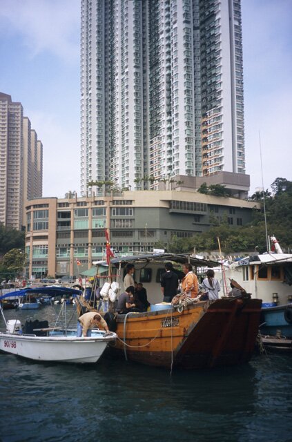
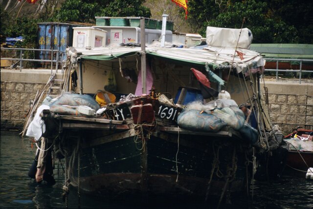
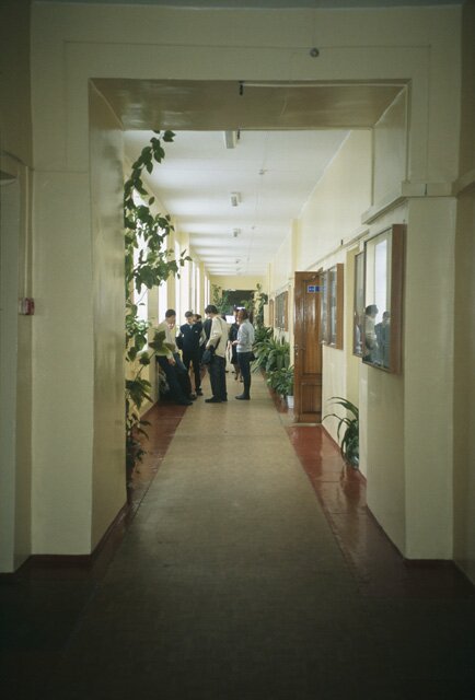
But, as I was reminded by the scenes pictured here, Hong Kong’s relentless drive comes at a price for many. You don’t want to find yourself in the path of progress, for you will have few friends and little or no legal recourse. In the Aberdeen District on the southwest shore of Hong Kong Island, the fishing boats seen here in the shadows of residential highrises are a historic link with the past, with families living aboard and working the waters between and beyond the islands.
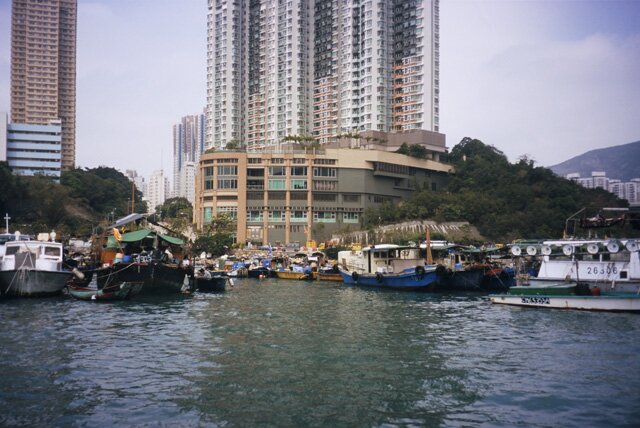
When I first saw this “colony” in 1979, I counted several hundred boats of all sizes, watched kids clambering over makeshift gangways as they left for school in their uniforms, smelled the flavors coming from on-board kitchens, and the water-borne village seemed a permanent fixture. But when tradition and modernization clash, traditional lifestyles tend to lose. Even before the SAR was proclaimed, the Hong Kong administration revealed its intention to close the Aberdeen fishing village down, and over time, many of the boat owners moved their vessels; others took land-based jobs in the burgeoning industrial and construction economy. But some held on, and you see them here, on China’s Memorial Day (Saturday, April 4 in 2009) when people everywhere visit the graves of their ancestors and commemorate others who have passed away. That is why, as my water taxi navigated the small bay, I saw people all dressed up, ready to make their day-long pilgrimage, as a taxi got ready to pick them up.
One stated reason behind the plan to remove the village altogether has to do with litter and disorder: some boats are neater than others.
And the government is not about to take half measures. By 2012, the water you see in the foreground will be replaced by fill, the boats will be gone, and new highrises will stand where this sheltered bay once sustained a traditional way of life.

When I asked locals about the legal rights of the inhabitants of the Aberdeen fishing village, I was told that they have none. No point in getting lawyers and trying to delay progress: the bulldozers will be here before the end of the year, and these people will have to adjust to the march of progress.
In Shanghai, Pollution Reigns
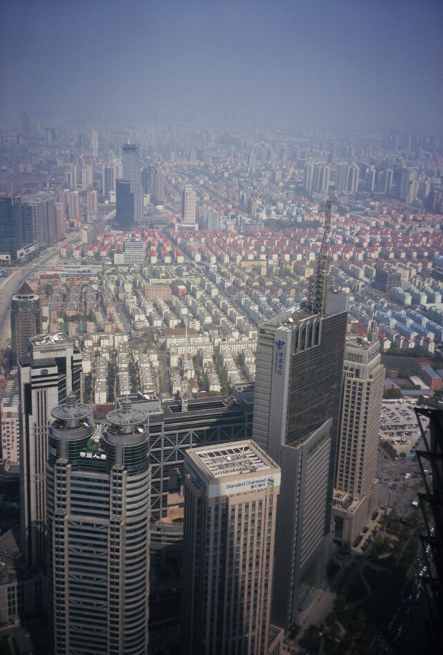
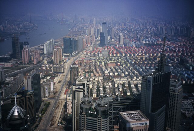
These photographs of Shanghai, showing the iconic Oriental Pearl Television Tower on the right bank of the Huangpu River and taken from the top floor of the Jin Mao Tower in Pudong, show spectacular vistas but also form a reminder of what is happening to the air in China, and not just in the major cities. A pall of pollution is obscuring the sun even on cloudless days, and from high vantage points like this it seems as though tall buildings rise from a lake of smog. The emanations spewed forth by China’s rapid industrialization have overtaken, by volume, those of the United States, hitherto the world’s most prolific polluter of the atmosphere. Even as things are to some degree improving in places like Los Angeles and Chicago, projections indicate that China, by 2020, may be producing twice the amount of pollutants emitted in America. In China’s streets, you see more and more people wearing face masks as they walk or bike the streets.
Old Shanghai lies across the river in each of the four photos looking west from the Jin Mao Tower, and highrise construction continues on both sides of the Huangpu.
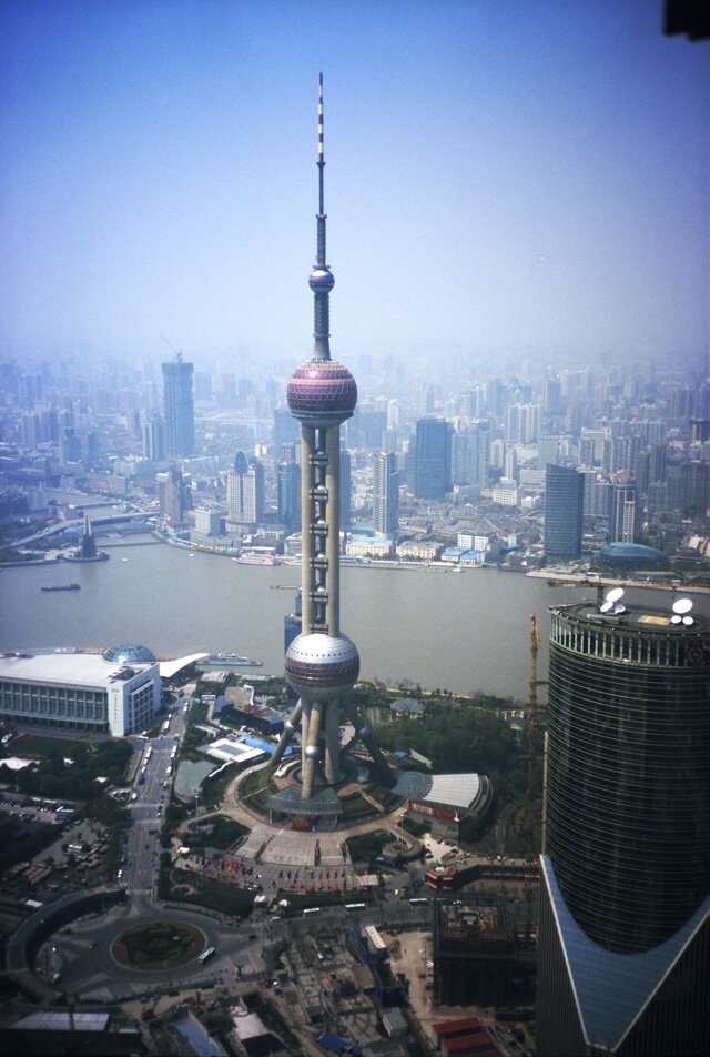

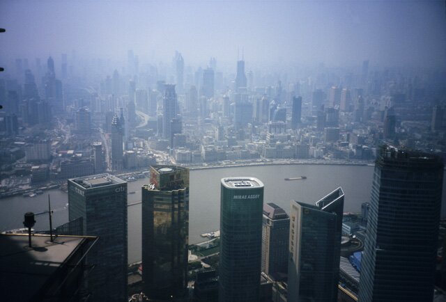
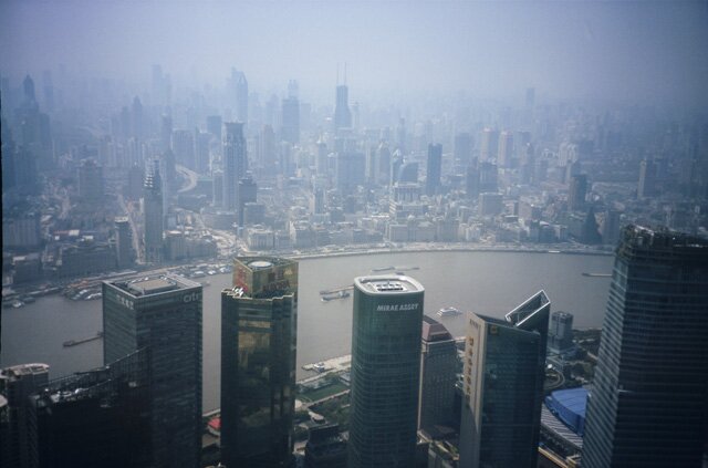
Look straight down and eastward, and you get a good picture of the cluster of skyscrapers built in just the past two decades.
Look beyond, and you see the grand design of the Pudong SEZ (Special Economic Zone): lowrise residential accommodations for the workers in the service industries based in the office and hotel towers.
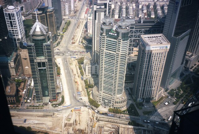
Back at ground level it is evident that construction of tall buildings isn’t over.

These cranes occupy a site right next to the Jin Mao Tower, and some of the views just seen will be obstructed by new construction. But in 2009 and early 2010, another project is taking precedence: Shanghai is the World Expo 2010 site, and upstream from these photos a gigantic project is underway to accommodate Chinese and international pavilions in what locals confidently say will be the “greatest expo in world history.”
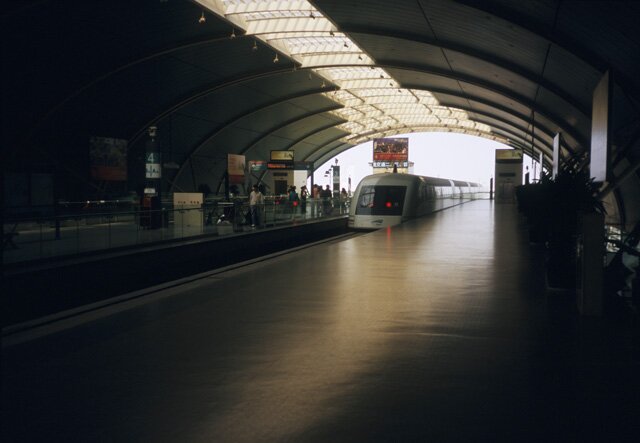
Shanghai’s Pudong District is famous for its architectural icons and forward-looking designs, but travelers marvel at another facility: the so-called Maglev train, that whisks you from the central city to the airport in a matter of minutes at 431 km (270 mi) per hour. Maglev stands for Magnetic Levitation, and even at over 430 kph you can walk around without any sense of movement.
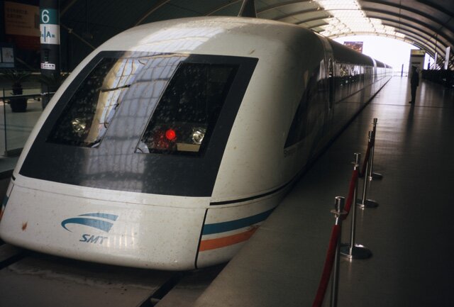
The train has its own platform in the city, runs every 15 minutes each way (so that when they pass, they approach each other at more than 500 miles per hour, creating a memorable ‘boom’ in the process), and is saluted by a uniformed officer upon arrival and departure as it leaves the station.
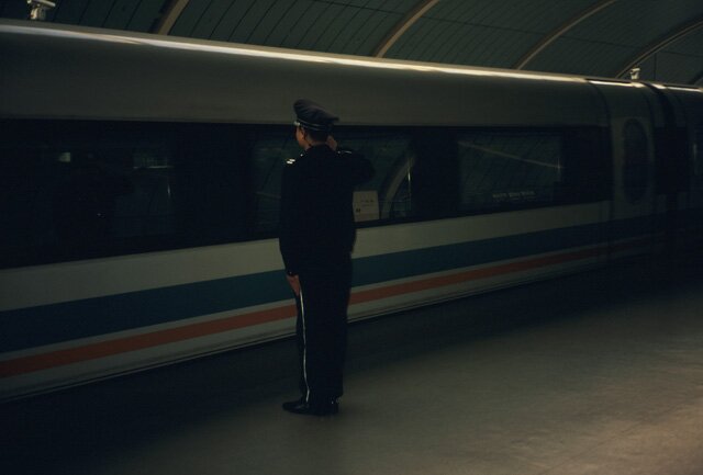
Appropriately so.
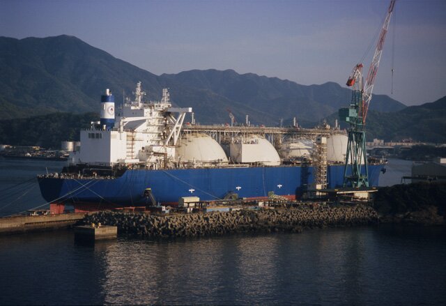
Sailing into the port of Nagasaki, you are reminded of Japan’s energy needs: an ultramodern facility for the transfer of liquefied natural gas a safe distance from the city.
After many tries over a 30-year period, finally a view of the snowy peak of Mount Fuji as it towers over the town of Shimizu

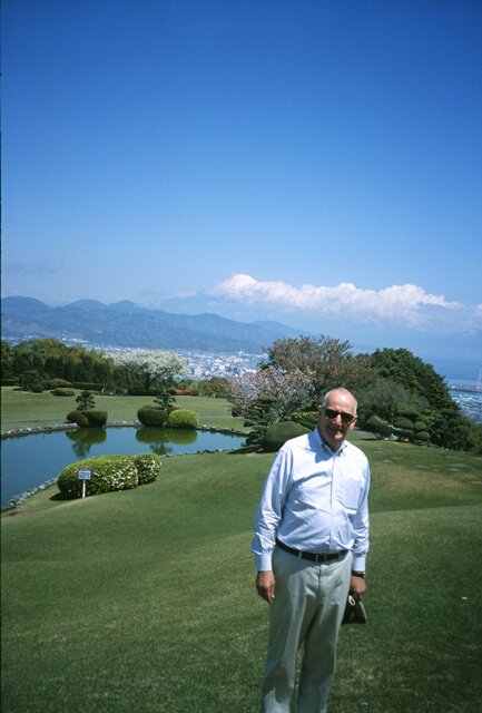
Northward, beyond the mountain, lies the Tokyo-Yokohama urban area, the largest of its kind in the world. The grounds of a hotel in the hills provide an opportunity for a “field shot”.

Note, in as well as this photo, how comparatively small the Fuji snow cap is. This struck me as I visited a museum in nearby Yui Town, Shizuoka Prefecture, the Tokaido Hiroshige Art Museum. Hiroshige Utagawa is a famed artist in the medium of woodblock prints, born in the late eighteenth century. He was a master of color, and did much of his work along the Tokaido Road, a coastal route he depicted in 53 “stages.” What makes Hiroshige’s work interesting to geographers is that many of his works show Mount Fuji in the background – and none of them displays a small snow cap of the kind existing today. Indeed, whether in a summer scene or a winter scene, Hiroshige’s Fuji has ice and snow all the way to its base. Many of his more than 1200 prints show winter scenes along the Tokaido – and the dates suggest that winters – when he was working – were long, cold, and snowy. The guide at the museum told me that such deep snow hasn’t been seen “by anyone alive” in the “stages” drawn by the artist. Did the Little Ice Age endure even longer in this area than it did in the western sector of Eurasia?
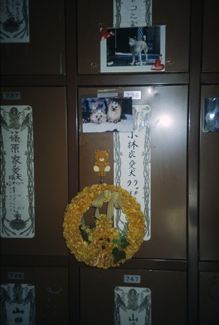
When societies become wealthier, they tend to devote more of their discretionary spending to pets and animal welfare. When I first saw urban Japan in the 1970s, seeing someone walking a dog was a comparative rarity (admittedly this is an anecdotal, not a replicable observation!). Today, it is far more common – as is the case, though still less so, in the burgeoning cities of coastal China. And when pets become valued family members, they are remembered as such. In Tokyo, I encountered this memorial to dogs and cats in a courtyard also housing a small Buddhist shrine.
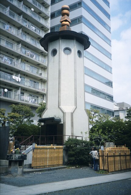
At first I thought that the octagonal building seen here was a place to honor ancestors, until I walked in the door and saw the religious figure flanked by fresh flowers and, behind this, what seemed to be small lockers with names on them.

Closer by, I realized that many of the small doors were adorned with flowers, pictures, even poems about the pets whose ashes were inside.
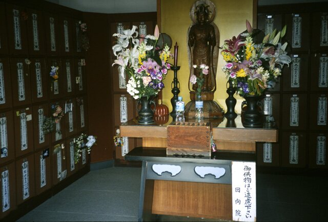

Number 739 had a picture of two small dogs and a wreath, and the scribble above the photo said “you were my whole life.”
Petropavlovsk, On the Road to Nowhere
Sail northward from Hokkaido along the eastern side of the increasingly snowy Kurile Islands, and suddenly the coastline becomes continuous, the land rises, and you’ve reached the southern end of the Kamchatka Peninsula. The landscape is forbidding: high relief, tall, snow-topped mountains, mixed vegetation rooted in relentlessly black ground. Black, because Kamchatka is one long volcanic ridge; geologists count 68 volcanoes designated as active. Volcanic emissions ranging from fine dust to clouds of ash come down in an almost continuous shower, so that many a snowfall is quickly covered by soot.
Snow was falling as the ship I had boarded in Yokohama entered the harbor of the peninsula’s largest city, Petropavlovsk. The destination lecturer, commenting on the scene over the intercom, said “welcome to Siberia”, but Siberia this is not. Indeed, for all the late-April snow and ice, we were at a latitude farther south than any point in Russia’s real freezer – Petropavlovsk’s latitude is lower even than Moscow’s. No Siberian landscape contains the vegetative diversity of Kamchatka.
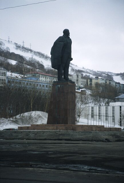
During the Soviet period, Russian citizens willing to move to the Russian Far East were rewarded with special privileges (being as far from Moscow as possible, my guide said, was actually reward enough). Soviet times are remembered fondly by many older inhabitants, and Lenin’s statue continues to loom over the communist-era square that was the scene of May Day celebrations and other patriotic ceremonies.
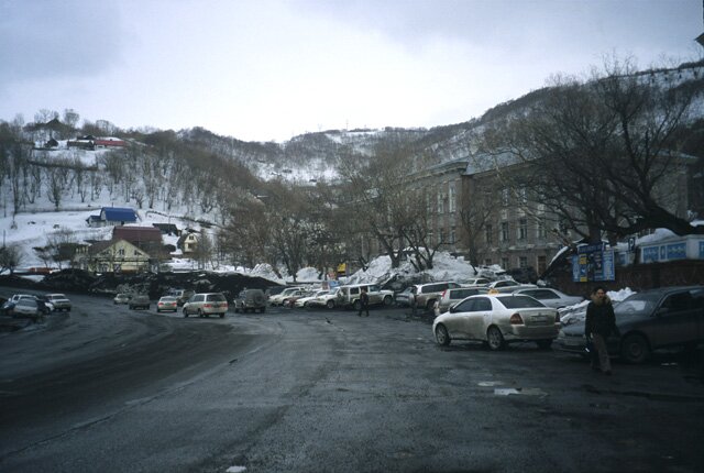
But today, Petropavlovsk is losing people at a rapid rate. At the time of the collapse of the USSR, in 1991, the population numbered 228,000. By 2001, it was below 200,000. Today, estimates range from 168,000 to as low as 145,000. As a federal district, the Russian Far East is losing population faster than any other part of Russia. It is a growing crisis, and relations with Moscow are not helping matters. In Petropavlovsk as in Vladivostok and other Far East cities, illegal moneymaking raises Moscow’s ire. One current (2009) activity involves the shipment of used cars, bought cheaply in Japan, to sales lots in Far East cities, where they sell at large profits. No import duties or taxes are paid, and when the government tried to impose regulations, the locals ignored them. When Moscow sent law-enforcement officers to the cities, confrontations and some violence ensued. Relations between east and west do not bode well for the future.
Petropavlovsk calls itself the second-largest city in the world without exit roads to anywhere (after Iquitos, Peru, but at least Iquitos has a river link). Look at the map, and you will find no roads through the peninsula’s neck to the outside world. Only sea lanes and air links serve Petropavlovsk, resulting in high prices for everything from supermarket goods to construction materials. With its population declining and its economic options limited (in the post-Soviet period, adventure tourism has become a source of revenues in addition to commercial fishing), Petropavlovsk’s failed hopes are reflected by abandoned building skeletons and crumbling roads.
No amount of (expensive) salt could combat the huge snow accumulations here, so volcanic ash is used on the roads;

soot also falls periodically from natural sources, producing a stratified profile when drifts are cleared.


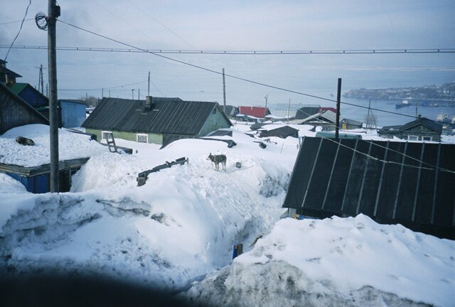
Lying at the foot of the volcano named Koryakskaya, Petropavlovsk has little level land, and on the slopes the ground tends to be loose and unbuildable, so that buildings cluster where conditions permit.


Soviet-era apartments still house most of the residents, and one of the Soviet-era privileges for some – small detached homes – cluster in small neighborhoods surrounding the restored Russian Orthodox church.

The copious use of ash on roads and walkways yields knee-deep, black mud when the Spring brings melting.

My colleague took me to the local open-air market, but we were unable to find a place to leave the car, and the stalls were encircled by deep pools of slush. She took me to the university, a modern oasis in this stagnating city, brightly lit, the students well-dressed and eager to show me their classrooms and projects.
Several faculty allowed me a look at the state-of-the art computer lab and cartography facility. Language teaching is a priority, and classes in English, Chinese, Japanese, and Korean are among the best-attended. My guide at the city’s museum was able to communicate in French and German, both learned at the university. “We are avid readers,” she said. “There isn’t much else to do here.”
A Brief Transit in Alaska
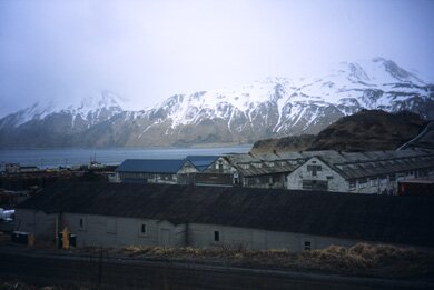
We skirted the Kuril Islands on our way to Kamchatka; now we crossed the Bering Sea to sail along the southern side of the Aleutians on the way Anchorage, from where I planned to fly to the US east coast in early May. The contrast between the forested Kamchatka Peninsula and the comparatively barren Aleutian Islands came into sharp focus on Unalaska Island, near the far western end of the Aleutians.

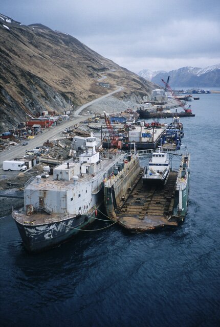
Dutch Harbor was given its name by none other than Captain Cook who, on a Pacific voyage, arrived in this protected bay to find a vessel anchored there, flying from its stern a huge Dutch flag. From the vast waters north and south of the Aleutians, a few hundred fishing people made Dutch Harbor the largest U.S. fishing port by tonnage in the 1990s. Overfishing, especially of king crab, and not only by American but also by Russian, Korean, Japanese, Taiwanese, and other fleets kept the town’s five large processing plants in operation, but today the biggest of these stands abandoned and much gear lies idled.
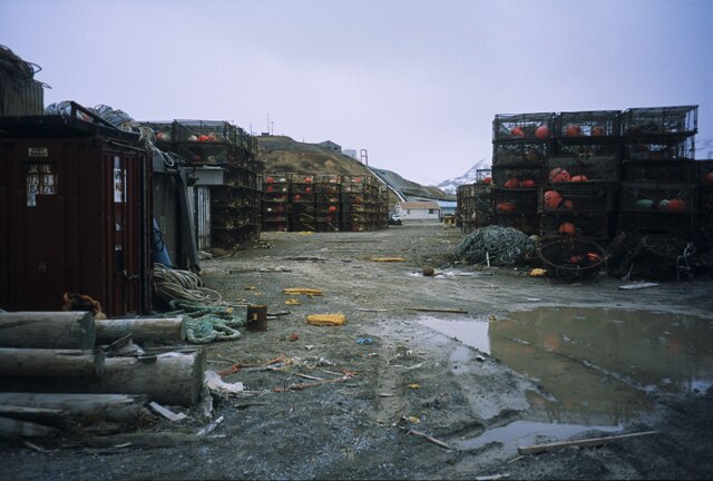
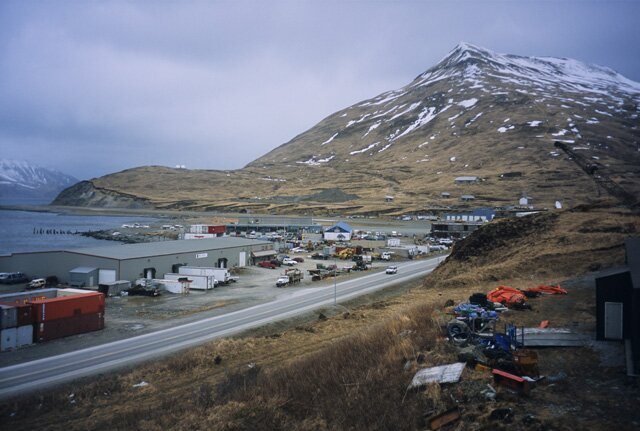
Dutch Harbor also serves as a repair and refueling center and “sport” fishing is a growing activity as visitors can fly into Tom Madsen Airport.
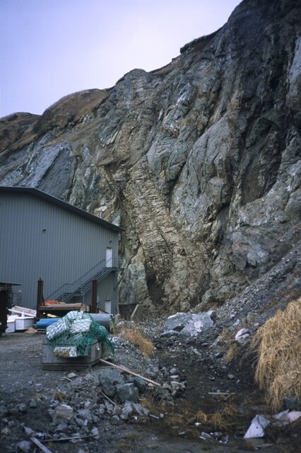
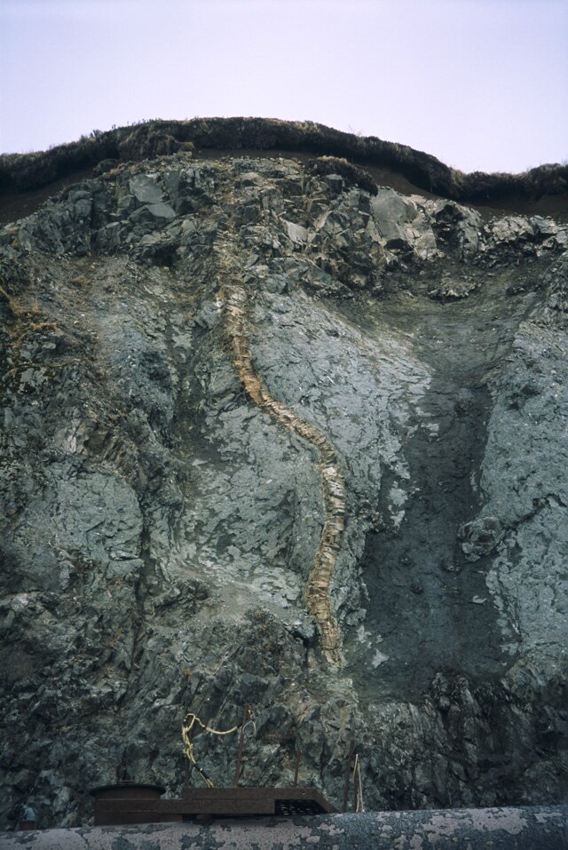
Walking from the pier into town about 3 miles away, you see some remarkable physical geography. It must have been a turbulent day when these two dikes penetrated the bedrock.
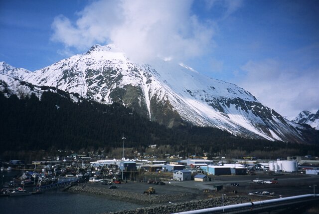
Seward is linked by road to Anchorage, but not on the day I arrived there – a rockfall had closed it and repairs were under way.
An unexpected low-level flight in a 27-year-old Navajo provided some excitement
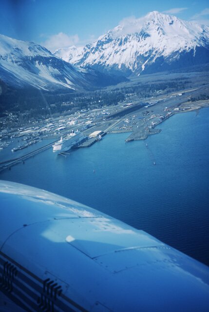
as the pilot, flying above valley streams and below cloud cover, wingtipped a few corners as we flew into and out of valleys as though they were downtown streets.

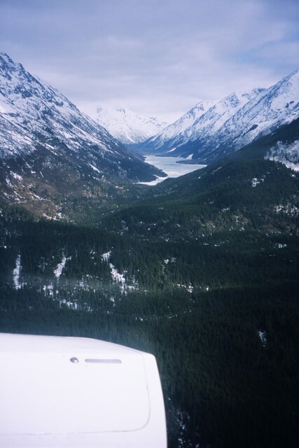

It took just 65 minutes from Seward to Anchorage, where we landed behind a China Airlines 747 in time for the connection to Minneapolis. No Russian bombers – or even Russia – in sight!
|